Site analysis is too slow
Manual data collection and fragmented checks delay decisions and increase project risk
For Real Estate Developers
Generate and compare planning scenarios with automatic KPI and compliance checks
Manual data collection and fragmented checks delay decisions and increase project risk
From boundaries to KPI reports, your team gets faster and more transparent planning decisions
A complete workflow for data-driven concept planning
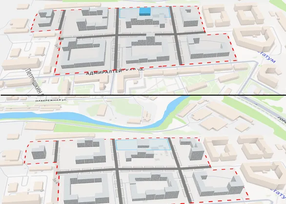
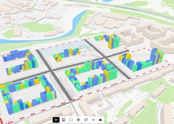
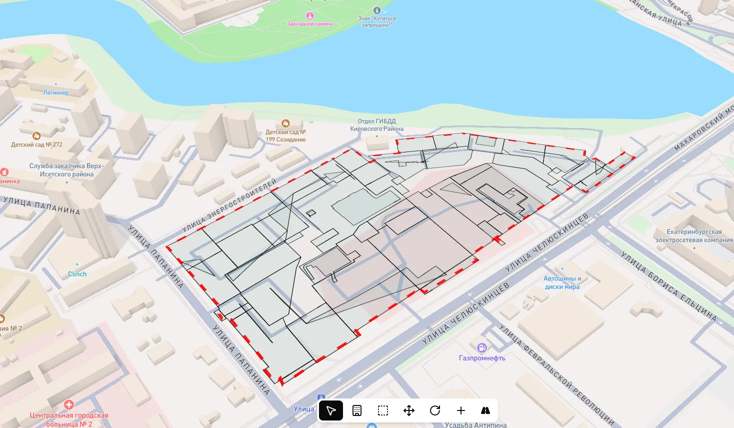
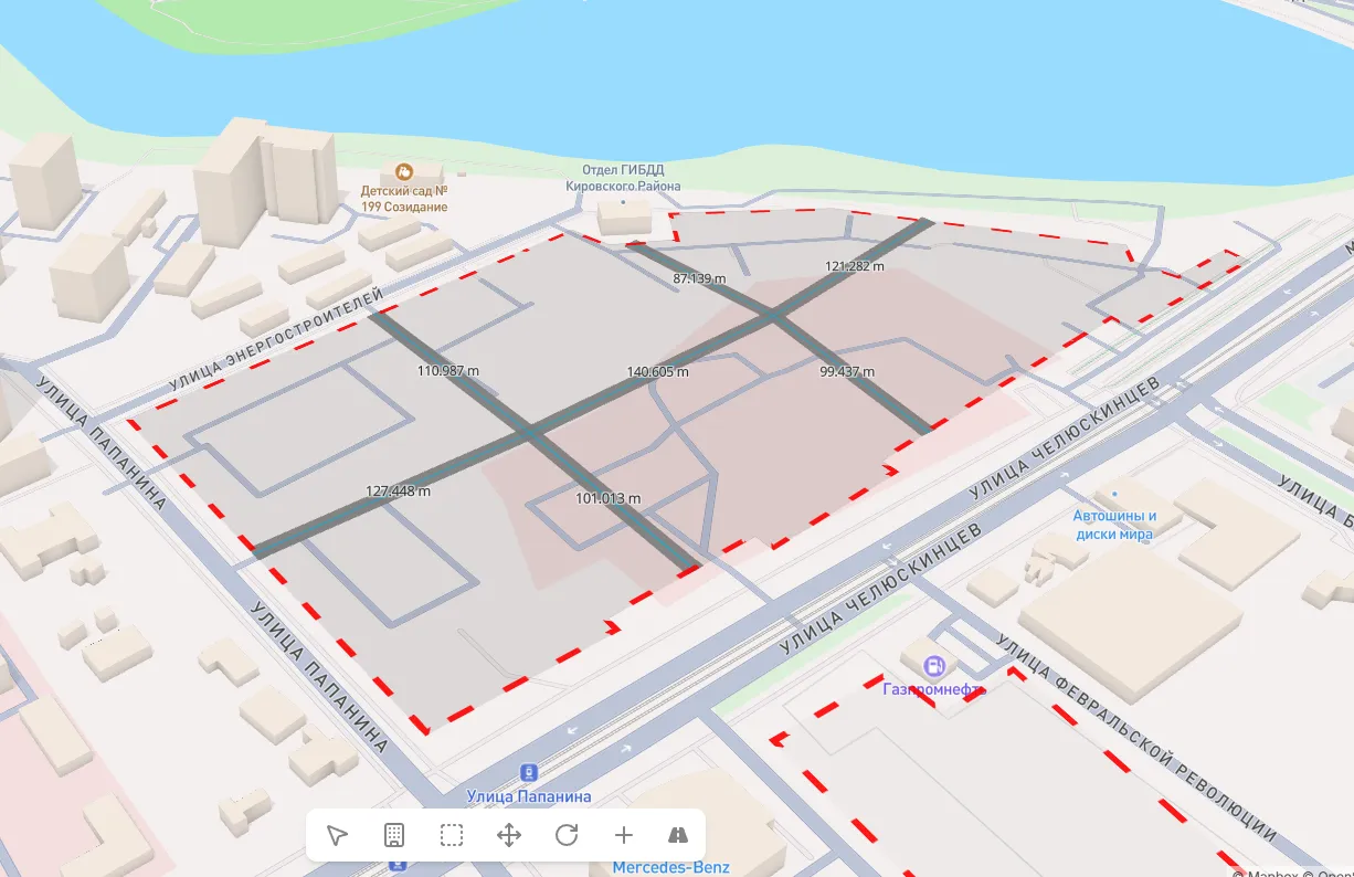
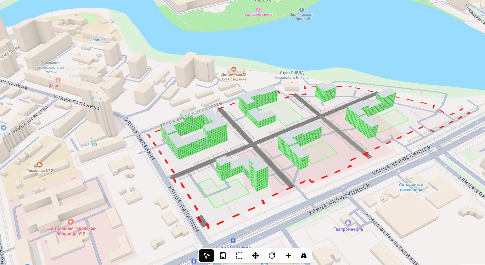
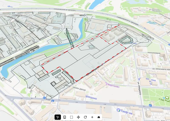
Import XML and DXF cadastral data files - the platform automatically creates site boundaries. Manage zoning: assign areas for kindergartens, schools, parking, and other facilities directly on the map.
What You Get
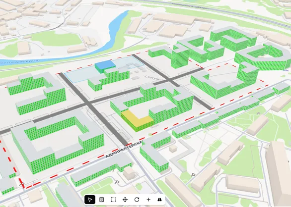
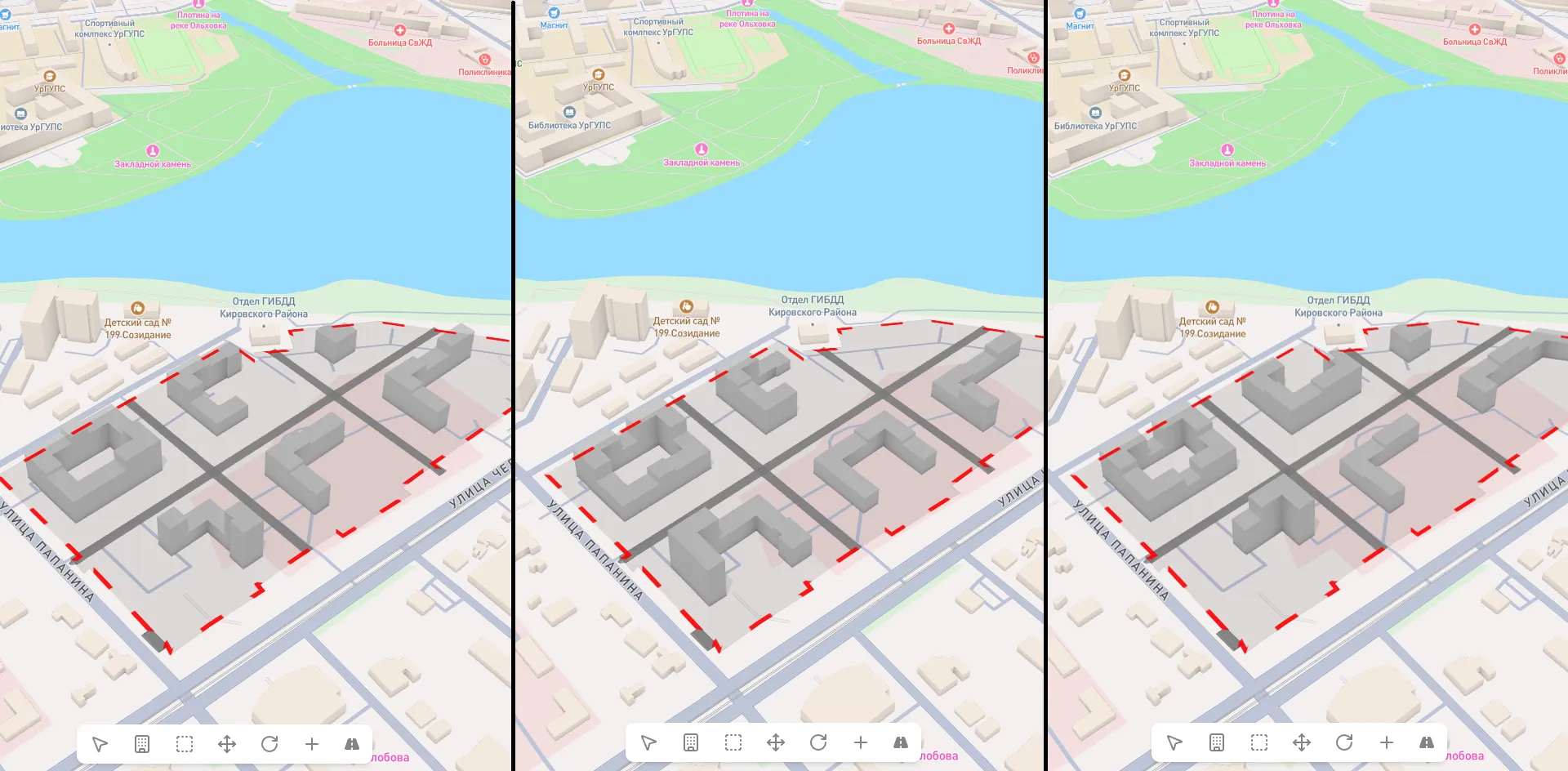
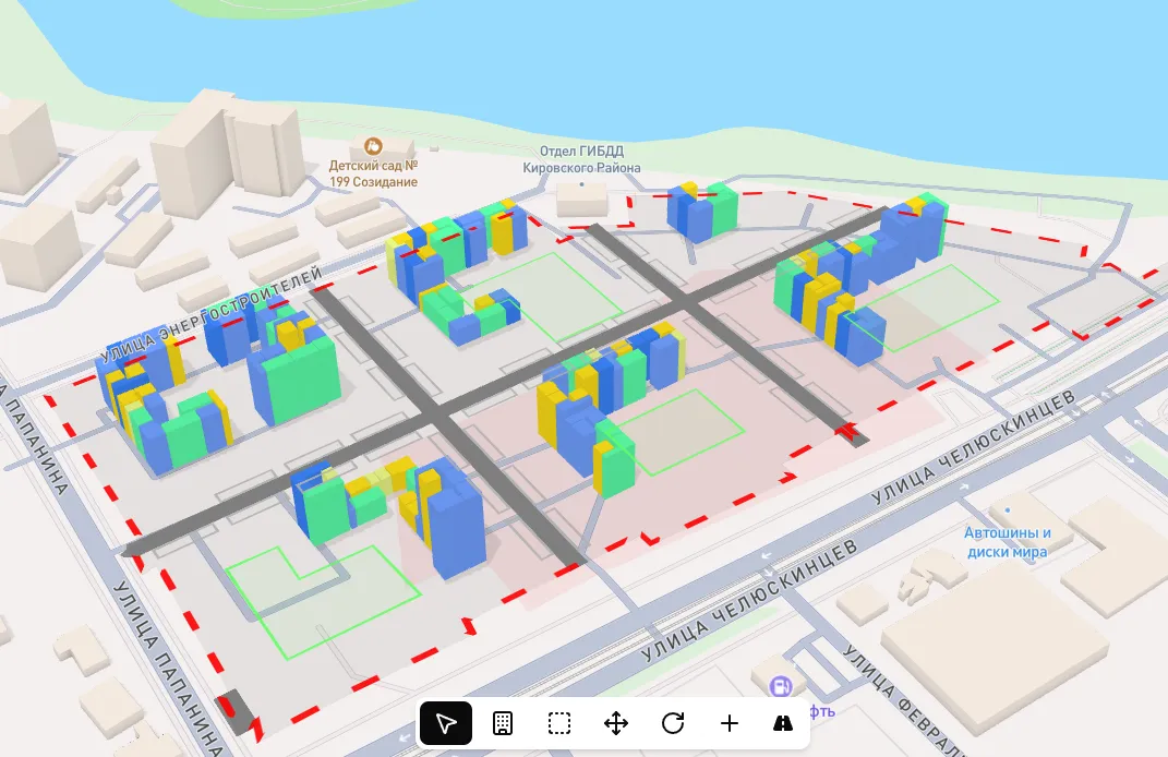
Building placement optimization for maximum sellable square footage output
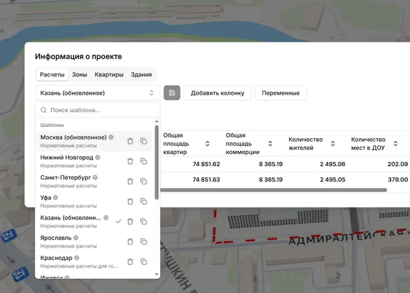
Complete key performance indicator table with Excel and PDF export
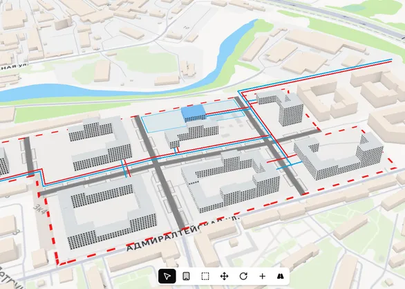
Automatic compliance with local standards, insolation, and infrastructure requirements
Site acquisition decisions based on data, not intuition
Why UrbanSketch
Test hypotheses 10x faster. More sites in the pipeline in the same timeframe
All figures backed by automatic calculations per current regulations
Eliminate human error in KPI calculations and constraint verification
Maximize sellable area on every site without regulatory violations
Real examples
Land acquisition
A developer evaluated 15 potential sites in 5 business days instead of two months, selecting the most profitable option
Concept
Five alternative development concepts for a 20-hectare territory with full KPI calculation and social infrastructure placement
Apartment layouts
8% increase in sellable area output through precise apartment layout optimization and typical floor plan refinement
10x
Faster site analysis
10+
Apartment layout options
15 min
Per concept calculation
100%
Automated KPI calculations
Invest in decision accuracy
Each plan is a level of analytical capability. Choose the scale that matches your development goals
$0
limited time - 1 month
Get to know the platform. Basic modeling, manual building placement, KPI calculation with standard regulations
$1,900 / year
$190 / mo -> $158 / mo $158 / mo billed yearly
Full site potential evaluation. Data import, insolation calculation, map integration, and result export
$4,900 / year
$590 / mo -> $408 / mo $408 / mo billed yearly
Systematic site evaluation with maximum building generation and social infrastructure placement
$8,900 / year
$990 / mo -> $741 / mo $741 / mo billed yearly
Enterprise deployment for large developers. Extended scenarios and priority support
On request
Maximum analytics level considering road network, existing social facilities, and utility infrastructure
Platform demo
Complete site analysis cycle: from boundary upload to KPI and apartment layout export